DYNAMIC SYSTEMS AND PROCESSES

Growing Networks
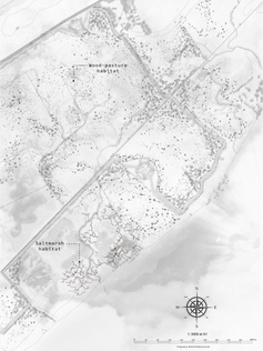
The essence, or 'genius loci' of the Intelligent Wilderness is the process of growth. As the wilderness grows so does the web of technology monitoring and responding to it. Along the journey of wilding, serendipity and surprise are key experiential qualities of the landscape. This project embraces these unpredictable and organic qualities and organises its design strategies to provide the space for these dynamic systems and processes to take place. In other words, the design strategy of this project works to create a landscape of opportunity. However, to balance the serendipity and surprise of nature is the steady monitoring and analysis provided by the observatories and embedded technologies. This counterbalancing system holds the opportunity to create an environment of resilience.


Wilding on Agricultural Land

Design Proposals
Enhancing and working with existing dynamic systems and processes
Chapter 1
Chapter 2
The proposal for the Last Harvest is based on the research by Fisseha Asmelash, Tamrat Bekele and Emiru Bihrane, The Potential Role of Arbuscular Mycorrhizal Fungi in the Restoration of Degraded Lands.
PART 1
Existing Conditions

PART 2
New Conditions

PART 3
Future Conditions


Agricultural Legacy
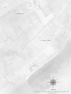
This project pays particular consideration to the legacy of agriculture in the region of the Cromarty Firth. Wilding and agriculture are often viewed as adversaries. Proposals for wilding is often criticised for ignoring, diminishing and even demonising agricultural practices and communities. The Intelligent Wilderness is sensitive to this topic, working to tease out opportunity within this challenge. The proposal outlines a roadmap towards the continuation of agriculture in the region, using wilding to enhance the richness of the land by restoring soil health, biodiversity and water management. In this way the two practices complement each other and increase the prosperity of the landscape and the human and more than human communities it supports.
The Story of Farming


Agriwilding
‘As experience at Knepp and elsewhere has demonstrated, farming and conservation need not – should not – be at loggerheads. Giving over areas that are not on prime agricultural land to nature ; ‘land sparing’ in the jargon – is farming’s greatest ally. By halting and reversing land degradation, securing water resources and providing insects for crop pollination, rewilding provides services vital to long term sustainablility of agriculture and food production.’
Isabella Tree, Wilding: The Return of Nature to a British Farm, p. 300-301

A Territorial Strategy
The work of this project around the town of Invergordon can be tied into a wider strategy reaching as far as the territory of the Cromarty Firth bioregion. After one Wild Commons Network has reached a
self-sustaining level and biological processes reach an equilibrium, a new Commons could be defined adjacent the the current boundary. Following this transition, with soil health restored, sustainable agriwilding practice could be introduced into the original Wild Commons Network, whist the new Commons undergoes the process of wilding. Each Network boundary should follow the same landscape planning sensibility of defining a peak to edge boundary, including a local town, building observatories in each patch and creating as diverse a range of habitat patches possible from the existing conditions. This process can continue around the Firth until the entire region is transformed into an Intelligent Wilderness.
Chapter 3: A Territorial Strategy
‘If soils can be restored at very little cost by a few decades of rewilding there could be enormous benefits for agriculture. A former senior advisor for Natural England, Gwil Wren, has suggested the idea of ‘pop-up Knepps’. An area of degraded land could be rewilded for, say, twenty, thirty, forty or fifty years or more – enough time to regenerate the soil and provide a period of emerging scrub habitat for birds and other wildlife – and then be returned to agricultural production. The land to be rewilded would be strategically planned over a much larger area – such as a river catchment, selecting specific areas that could become stepping stones or corridors of nature to reconnect the landscape. As one piece of land is taken out of rewilding and returned to sustainable agriculture, another vicinity embarks on re-wilding; ensuring the same amount of land remains under rewilding to balance the amount of land under agriculture – comparable to the traditional rotational system of leaving fields fallow – only much more extensive and on a longer time-scale.’
Isabella Tree, Wilding: The Return of Nature to a British Farm, p.283


